project
Illustrated Maps
Unique illustrated maps combining research, storytelling and illustration
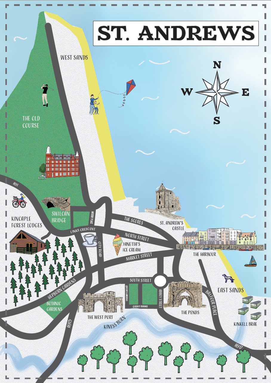
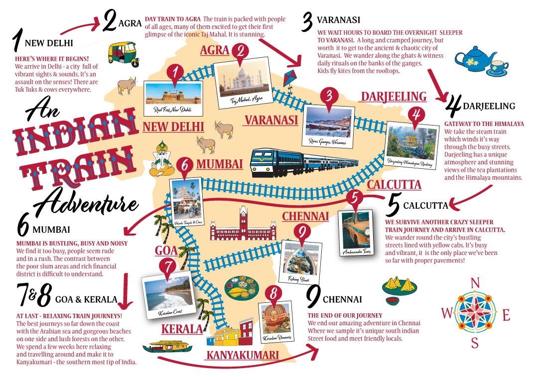
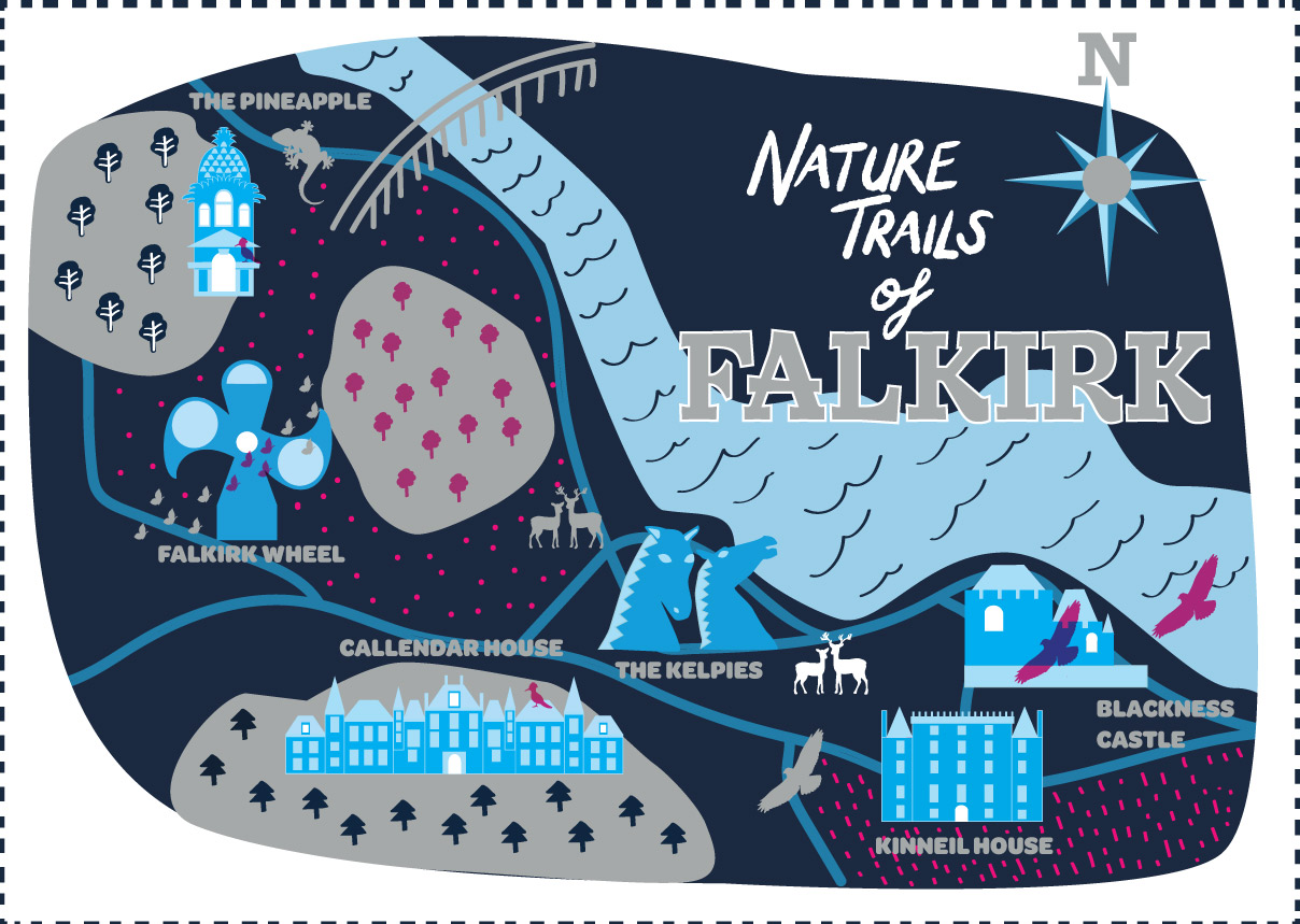
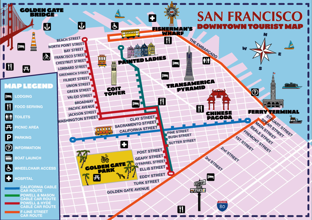
Custom Illustrated Maps
Map Design
I have always found maps fascinating and love unique illustrated maps which tell a story.
I create bespoke illustrated maps that celebrate place, story and identity – ideal for a visual personal journeys – or for tourism, heritage and culture.
My maps are custom designed pieces that combine research, storytelling and illustration to bring places to life.
My maps are suitable for print, digital use or exhibitions.

